Monday: Partly to mostly sunny. High near 88 with a low around 63
Tuesday: Mostly cloudy with thunderstorms possible. High near 85 and a low around 65.
Wednesday: Mostly sunny. High near 90 with a low around 68
Forecast:
An abnormally warm pattern for late April and early May is in store for south central Kentucky for the next week or so. Temperatures in the high 80s, possible reaching 90 in places, are 10 to 15 degrees above normal for this time of the year.
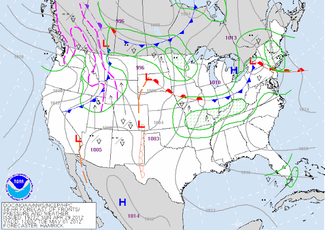
With the jet stream stationed north of the Canadian border and continual height rises expected throughout the week, the anomalous heat we're experiencing doesn't appear as if it's changing any time soon. Monday's forecast will include partly to mostly sunny skies as the frontal boundary oriented from the Oklahoma panhandle northeast to the Iowa/Illinois border and eastward through the Bluegrass migrates east-northeastward. We will likely see some cloud cover and even a shower or two during the overnight as convection from the west travels eastward.
Tuesday looks to be our best shot at some rain and a very brief respite from the heat. Showers are expected after moisture advection from the Gulf of Mexico continues to desabilize the boundary layer. After the front lifts further northward, a strengthening ridge should keep us dry for the rest of the week.
The next forecast will be issued Thursday, and any new developments will be posted to our social media sites.
Lead Forecaster: Jeremy Young

No comments:
Post a Comment
Note: Only a member of this blog may post a comment.