As we get nearer to sundown, what threat that existed for severe weather will continue to decrease. Currently, a severe thunderstorm watch and a tornado watch are in effect for areas to our north, much closer to the frontal boundary oriented from Louisville east-southeast toward Richmond. Here are links to the
severe thunderstorm watch and to the
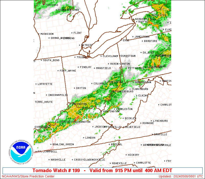
tornado watch. A strong cap is in place over most of south central Kentucky, including Bowling Green and all of Warren County. Considering this and the relative lack of moisture (see the image below), we should continue to have calm weather until tomorrow.
 |
| Surface winds and 850 mb winds have transported the majority of the moisture in the region to our north, supplementing the storms crossing the Ohio River at the moment. The dark green areas show dewpoints in the 60º F to 64º F range |
Tomorrow is another day that places us under a slight risk for severe weather, but once again we're along the boundary of the warning. Models show the cap that has protected our portion of the state eroding by the early afternoon tomorrow, possibly as early as 10:00 AM. We'll have plenty of moisture and have that moisture supplemented by southerly flow as the day progresses. Effective shear values in the 30 to 50 knot range should help to organize storms that develop. Ultimately, unless we have some clouds and precipitation advect into the area between tonight and tomorrow morning, the stage will be set for storm development.
Tomorrow's threats still look to be large hail and damaging winds.
Lead Forecaster: Jeremy Young

No comments:
Post a Comment
Note: Only a member of this blog may post a comment.