As the front passes Bowling Green tomorrow morning, look for temperatures to plummet into the low 30s. This may be cold enough for some snow to develop, but no accumulations are expected. Rain will most likely form ahead, changing to light snow with the front tomorrow morning.
 | |
| This figure shows the HRRR model for early tomorrow morning. Current thoughts are temperatures will be above freezing with very light snow showers between 5:00AM and 9:00AM. |
 |
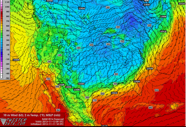
| NAM model map for surface temperatures for early morning Wednesday. Notice the cold air dominating Kentucky and holding strong. |
Monday Night: Showers beginning to develop late tonight. Winds becoming more northerly 12-15mph. Low temperature of 33.
Tuesday: High temperature of 39 with a low of 24. Sustained winds at 10-15mph with gusts near 35mph. Rain turning to snow showers tomorrow morning with no accumulation expected, then clear skies going into the night.
Wednesday: High temperature of 45 degrees with a low of 24 with clear skies. Winds turning southerly in the night.
Thursday: High temperature of 50 with a low of 35. Warming trend continuing into the weekend with southerly winds.
Forecaster: Brian Urbancic
No comments:
Post a Comment
Note: Only a member of this blog may post a comment.